
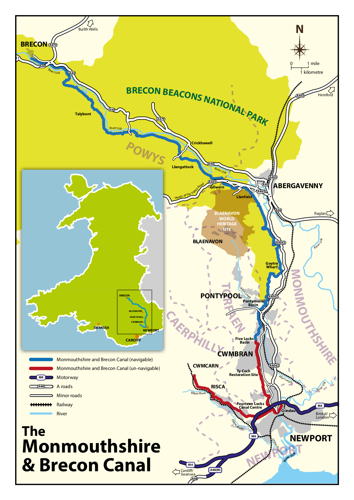
The Monmouthshire and Brecon Canal is a relatively modern name for two separately constructed canals which were joined in 1812. The Brecknock and Abergavenny Canal, and the Monmouthshire Canal. You can read more about the history of the canals on our History of the Canals page.
Planned by Thomas Dadford Junior, the canals are a classic example of early contour canal construction. They follow the lay of the land where they can and wind their way along the hillsides. This technique minimised the need for expensive locks, cuttings and tunnels, but inevitably made the canal longer. With better engineering knowledge later canal builders were to introduce more cuttings, locks, tunnels and imaginative boat lifting machines.
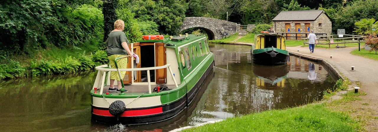
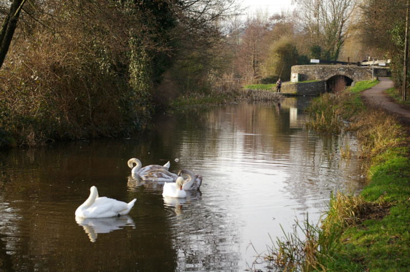
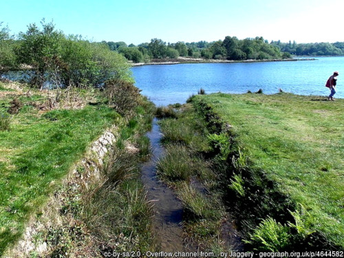
The canal today is viewed by many as the most beautiful in the UK. Unlike many canals in other parts of the UK, which wend their way through urban and industrialised areas, our canal is primarily a rural canal. Winding its way along the hillsides the northern section affords spectacular views of the surrounding countryside. For most of its navigable length the canal runs through the Bannau Brycheiniog National Park (formerly the Brecon Beacons National Park).
Starting at Brecon, the canal today has a 35 mile navigable section, with an unnavigable southern section. You can view the navigable and un-navigable sections on our maps page.
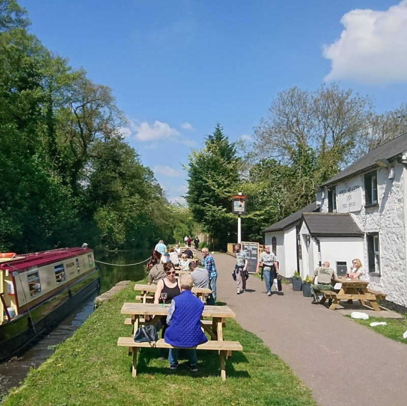
The navigable section was restored from Brecon and Five Locks Basin between 1970 and 1997, and is well used by boaters, walkers and cyclists. It is the most visited attraction in the Bannau Brycheiniog National Park (BBNP Survey 2013). It supports 7 boat companies operating 65 holiday-hire boats, 16 day-hire boats, 6 canoes, together with 4 skippered passenger trip boats. Three marinas and online permanent moorings also accommodate over 350 private boats. A large number of canal-side businesses such as pubs and shops along its meandering route south from Brecon rely on its pulling power to generate trade. It is estimated that currently the canal’s three million visits generate spend of some £17 million each year in the local economy (Ecotec 2007).
The southern unnavigable section runs from Five Locks Cwmbran to Newport Barack Hill Tunnel entrance, with the Crumlin Arm branching off the main line just after the canal passes under the M4 Motorway. Even though it is not navigable it functions as a popular linear park enjoyed by walkers, cyclists and fisherman.
Much of the damage to the canal infrastructure in the presently unnavigable section has been caused by road “improvements”, such as replacing the traditional hump-back bridges with flat decked modern replacement which did not allow headroom for boats to navigate, and long lengths culverted to allow road building.
The Monmouthshire Canal Main Line
Damage to the canal is not an entirely new phenomena, as railway companies who took over the canal, share some of the blame. The Monmouthshire Canal’s original Northern terminus was at Pontnewenydd, Pontypool. However in 1853 this 1.5 mile length from Pontymoile had been converted to railway use with the loss of 11 locks, and more significantly, much of the water supply to the lower canal. At the southern end of the canal at Newport, the canal once ran a further 1.4 miles to Old Town Dock, in Pillgwenlly. It was first shortened in 1879, and further reduced in the 1930’s to its present end at the portal to Barrack Hill Tunnel. Most of its former route is occupied by the Newport Kingsway dual carriageway.
Much of the more recent damage done to the “Main Line” has occurred in Cwmbran, a “New Town” created by the Cwmbran Development Corporation (CDC), an organisation with planning powers set up in 1949. Locks have been converted into decorative cascade features, canal brides have been replaced with culverts, and sections of canal filled in and culverted.
This lack of foresight continued until up until the 1980’s, a time when canal restoration was well supported in England, when a long length of canal south of the current Cwmbran B&Q Warehouse was destroyed to build Cwmbran Drive, Greenforge Way and its associated roundabout. The canal could have been diverted and rebuild on a altered alignment, but this was not done. The proposal was subject of a Local Public Inquiry at which local canal societies at the time objected. Whilst failing to prevent the destruction of the canal line they were successful in persuading the Inspector and Secretary of State that an alternative line should be identified in the event that the canal was restored in the future. However the route identified requires the building of a new tunnel or aqueduct to bridge the gap caused by the building of Greenforge Way, adding a signifiant challenge and cost to the present restoration proposals. The Cwmbran Development Corporation was dissolved in 1988!
This decision was the impetus that led to the setting up our Trust in 1984. We are determined that such an act of vandalism should not happen again.
The Crumlin Arm
Damage has also occurred along the Crumlin Arm. At its northern end, 3 miles of canal between Cwmcarn and Crumlin was destroyed to construct a new A467/B4591 road in 1968/9, with only short isolated sections remaining. Further south some sections have been culverted, a small aqueduct removed, and some canal bridges replaced with culverts. Thankfully the engineering wonder of the Crumlin Arm, the Cefn Fight of 14 locks at Rogerstone in Newport remains largely intact.
The Crumlin branch was abandoned as a commercial waterway in 1930, but was kept in water. In February 1946, a serious breach occurred at Abercarn, 2.5 miles (4.0 km) from Crumlin, and although this section of the canal had not been used for 16 years, the breach was repaired.
However, the branch was closed just three years later in 1949.
The section from Pontywaun to Crumlin was filled in and used as the route for upgrading the A467/B4591 in 1968/69. The road was built to upgrade the B4591 in 1968/69, with only short isolated sections of canal remaining. The construction of the new road also severed the canal from its main water supply at Pen Y Fan Canal Reservoir, (now widely referred to as Pen y Fan Pond) which has caused water shortage problems ever since.